Dunedin does walking well. In under an hour you can swap the Octagon for wind-cut cliffs, tūī-filled bush, harbour lookouts and long beaches where the only soundtrack is surf. The trick is matching the right track to your day, your fitness and the scenery you are chasing.
This guide is built for exactly that. First, a simple way to choose a walk by difficulty, length and landscape. Then, 15 local favourites, from short sunset strolls to half-day hikes on the Peninsula and the city’s green belt. Distances and times are approximate and assume a steady walking pace, always check conditions and any closures before you go.
Quick local planning tip: if you want the official track notes, hazards and updates, start with the Department of Conservation (DOC) pages for the Dunedin area and the Otago Peninsula. They are the most reliable source for what is open right now and what to avoid after rain.
External authority: Department of Conservation, walking and tramping guidance.
How to choose a Dunedin walk by difficulty, length and scenery
When locals say a track is “easy” in Dunedin, it can still mean stairs, mud, sand, or a steady climb back to the car. Use these three filters and you will almost always pick the right option.
- Difficulty: Easy (mostly formed track, modest hills), Moderate (sustained climbs, rougher surface), Hard (longer, steeper, exposed, or remote).
- Length and time: 30 to 60 minutes, 1 to 2 hours, 2 to 4 hours, or a full day.
- Scenery type: Coastal cliffs, surf beaches, harbour views, native bush and waterfalls, skyline ridgelines, wildlife-focused.
Safety basics that matter here: coastal tracks can be slippery and exposed, Peninsula tracks can be windy, bush tracks can be muddy year-round. Take a warm layer, a windproof shell, water, and a torch if you are anywhere near dusk. If you are heading to the coast, time it around the weather and swell.
If you are trying to keep your footprint light, walking is one of the easiest low-emissions ways to do Dunedin. It is worth reading how the city is tracking on climate targets in Dunedin cuts emissions 13 per cent but will likely miss 2030.
Best short coastal walks in Dunedin (under 1 hour)
If you want maximum scenery for minimum time, Dunedin’s cliff-edge tracks deliver. These are ideal for visitors, families with older kids, or a quick post-work reset.
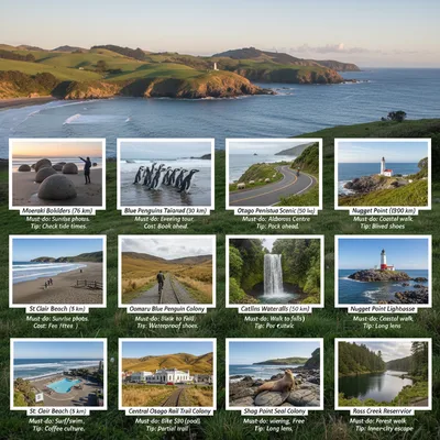
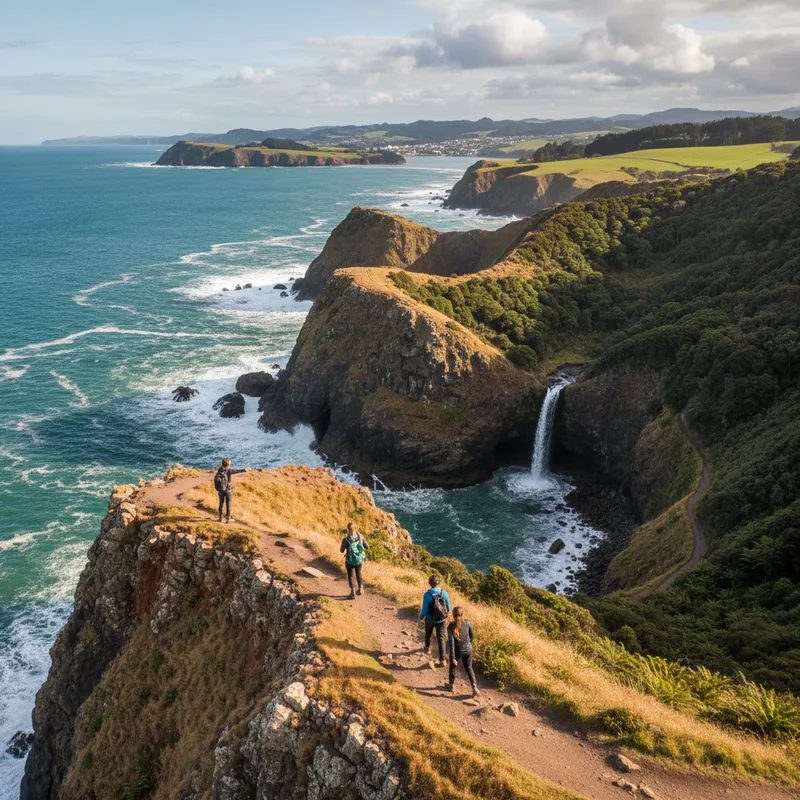
1) Tunnel Beach Track (Caversham)
Scenery: sea-carved cliffs, tunnel, natural arch and beach. Difficulty: easy to moderate because of the steep return climb. Time: 45 to 75 minutes return. Distance: about 2 km return. Start: Tunnel Beach car park, Green Island Bush Rd, Blackhead, Dunedin.
Expect a steep descent on a formed track with steps in places. The beach section changes with tide and swell, so keep back from cliff edges. It is one of the city’s most photographed walks, for good reason.
2) John Wilson Drive to Lawyers Head (St Clair)
Scenery: big beach views, coastline and surf. Difficulty: easy on sealed road. Time: 30 to 60 minutes return depending on where you start. Start: John Wilson Dr, St Clair, Dunedin.
Because it is on a road above St Clair and St Kilda beaches, it suits prams and anyone wanting a flat option. Go late in the day for light on the water and watch for cyclists and vehicles.
3) Soldiers Memorial Track (Otago Peninsula)
Scenery: classic Otago Harbour viewpoint. Difficulty: easy but short and uphill. Time: 10 to 20 minutes return. Start: pull-off near Highcliff Rd, Otago Peninsula (look for the memorial track signage).
This is a quick win on a Peninsula day. Pair it with a longer beach walk like Sandfly Bay, or with a visit out to Taiaroa Head.
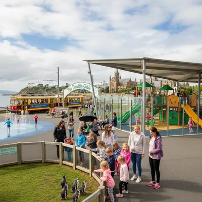
4) Taiaroa Head walks and viewpoints (near Royal Albatross Centre)
Scenery: cliffs, lighthouse views, seabirds and harbour mouth. Difficulty: easy. Time: 20 to 60 minutes depending on the loop you choose. Start: end of Otago Peninsula, Harington Point.
This is where Dunedin’s wildlife reputation becomes real. If you are visiting during the city’s nature calendar, check the programme for Wild Dunedin festival returns with packed nature programme, it often points you to guided walks and talks that add context.
Best beach and dune walks on the Otago Peninsula
For many locals, the Peninsula is the weekend reset button. These tracks are about expansive views and moving through open landscapes, with the trade-off being wind, sand and exposure.
5) Sandfly Bay track to the beach
Scenery: dunes, seals and sea views. Difficulty: moderate because the dunes are steep and soft. Time: 1.5 to 2.5 hours return. Start: Sandfly Bay car park, Seal Point Rd (via Highcliff Rd).
Plan for the climb out. In summer, carry extra water and sun protection, there is little shade. Keep respectful distance from wildlife on the beach.
6) Sandymount Track viewpoints (Allans Beach and Hoopers Inlet)
Scenery: sweeping harbour and ocean views. Difficulty: easy to moderate. Time: 45 to 90 minutes return for the main viewpoints. Start: Sandymount Recreation Reserve area, Otago Peninsula.
Parts of the historic longer route have had closures over the years for safety, so treat signage seriously and do not cross barriers. The viewpoints alone still give you that classic Peninsula panorama.
7) Victory Beach and Pyramids area (near Okia Flat)
Scenery: remote-feeling beach, dunes and cliffs. Difficulty: moderate. Time: 2 to 3 hours return depending on route. Start: Okia Flat car park, near Papanui Inlet Rd.
Victory Beach has a wild, end-of-the-road feel. It is best on a fine day with a settled forecast. Tracks can be muddy after rain and the beach is exposed.
Best bush walks and waterfall tracks near Dunedin
If you are craving shade, birdsong and mossy gullies, head inland. Dunedin’s bush tracks are particularly good after light rain, but they can get slick and muddy, wear proper shoes.
8) Nicols Falls Track (Bethunes Gully)
Scenery: native bush and waterfall. Difficulty: easy to moderate depending on mud. Time: 45 to 90 minutes return. Start: Bethunes Gully car park, North Rd, Dunedin.
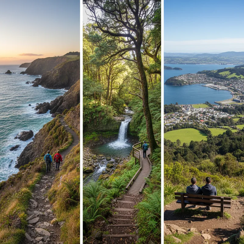
The falls are most impressive after rain. Bring a torch if you are planning to look for glow worms in nearby areas, and be ready for slippery sections.
9) Ross Creek Reservoir and Pineapple Track (Leith Valley)
Scenery: bush, creek, reservoir and big rimu. Difficulty: easy to moderate. Time: 1 to 3 hours depending on loop. Start: Ross Creek Reservoir car park, Leith Valley Rd, Dunedin.
This is one of the best “choose your own adventure” networks close to town. You can do a short reservoir wander or link up longer climbs onto the Pineapple Track and beyond.
10) Orokonui Ecosanctuary tracks (Waitati)
Scenery: protected forest, native birds, interpretation panels. Difficulty: easy to moderate. Time: 45 minutes to 2+ hours inside the sanctuary. Address: 551 Blueskin Rd, Waitati. Hours and entry: check orokonui.nz.
Orokonui is a different kind of walk, you are inside a predator-fenced ecosanctuary. It is a strong option for families and anyone who wants a high chance of seeing native birds. If you are into citizen science, it pairs nicely with the idea behind University of Otago launches BioBlitz to map campus life, take a notebook and log what you notice.
Best city-side nature walks close to the CBD
You do not have to drive to get a worthwhile walk. Dunedin’s Town Belt and valley tracks give you bush pockets and viewpoints within minutes of the centre.
11) Dunedin Botanic Garden to Ross Creek (link walk)
Scenery: formal gardens into native bush. Difficulty: easy. Time: 1 to 2 hours one way or return, depending on route. Start: Dunedin Botanic Garden, 6 Opoho Rd, North Dunedin. Hours: daily daylight hours, free entry.
Start among the gardens, then follow the Water of Leith pathways and connect into the Leith Valley tracks. It is ideal if you want a half-day without committing to a Peninsula mission.
12) Flagstaff summit track options (from the end of Flagstaff Rd)
Scenery: skyline views, tussocky top, big weather. Difficulty: moderate. Time: 2 to 4 hours return. Start: Flagstaff Rd end area (check for parking and track entrances).
Flagstaff is the city’s weather barometer. On a clear day it is a top-tier viewpoint walk, on a bad day it can be cold and exposed. Treat it like a proper hike and pack layers.
Best longer half-day hikes for fit walkers
These are the ones you save for a settled forecast and a free morning or afternoon. They are not technical, but they do require fitness and a bit of planning, and if you’re looking for inspiration for your next adventure, check out Ontario’s best hikes: 15 trails.
13) Silver Peaks: Jubilee Hut (out and back)
Scenery: ridgeline views, tussock and bush transitions. Difficulty: hard. Time: 5 to 7 hours return for many walkers. Start: Silver Peaks Scenic Reserve access points vary, most common approaches are from the north of the city toward Waitati and the Silver Peaks area.
This is where you feel like you have left the city behind. Weather can turn quickly and the track can be boggy. Take a map, extra food and start early.
14) Harbour Cone (Hereweka) track network
Scenery: 360-degree views over Otago Harbour and the Pacific. Difficulty: moderate to hard. Time: 2.5 to 4 hours return depending on route. Start: various access points on the Peninsula, including near Highcliff Rd and Harbour Cone Rd.
Harbour Cone is a classic “earn your view” climb. It is also culturally significant, stick to formed tracks and respect any access guidance.
15) Mount Cargill summit and organ pipes (via Bethunes Gully or other routes)
Scenery: basalt columns, wide city and harbour views. Difficulty: moderate to hard. Time: 2.5 to 4.5 hours return depending on route. Start: Bethunes Gully or other signed trailheads around Mt Cargill.
Mount Cargill is a favourite for people training for longer tramps. The organ pipes area is striking, but it can be slippery, take care on the rocks and keep kids close.
Practical tips: transport, timing, gear, and post-walk eats
Getting there: Many Peninsula tracks require a car, but several city and coastal options are reachable by bus plus a short walk. For popular spots like Tunnel Beach and Sandfly Bay, arrive early on fine weekends to secure parking.
Best time of day: For cliff and beach walks, aim for morning light or late afternoon. For bush walks, midday can be warmer and brighter in winter.
What to pack: waterproof jacket, warm layer, water, snacks, sun protection, and shoes with grip. In colder months, carry gloves and a beanie for any skyline track.
Track etiquette: stay on marked routes, keep dogs controlled where permitted, and give wildlife plenty of space. If you are taking photos, do it from stable ground, not cliff edges.
Post-walk food: If you have walked yourself into a proper appetite, our locals’ shortlist is in The ultimate guide to Dunedin’s best restaurants for dinner, and for a quick refuel there is The ultimate guide to Dunedin’s best cafes for coffee and a proper feed.
If you are adding a Peninsula attraction: a lot of families combine a walk with a Castle visit, and it is worth checking deals like Larnach Castle offers free entry for children these school holidays when they pop up.
Cross-site read: If you are the type who collects city trail guides, you might also enjoy an international take like The ultimate guide to renting in Sydney, not hiking-related, but useful if you are comparing city living logistics.
How to build your own perfect Dunedin walk (three sample itineraries)
Easy, 60 to 90 minutes, coastal: John Wilson Drive to Lawyers Head, then St Clair esplanade.
Moderate, 2 to 3 hours, Peninsula views: Sandymount viewpoints, then Victory Beach if weather is settled.
Hard, half-day, big climb: Mount Cargill summit and organ pipes, start early and pack layers.
Finally, remember that Dunedin is a place where the weather can change in a single walk. If the wind is brutal on the coast, swap to a sheltered bush track like Nicols Falls. If the bush is sodden after days of rain, go for a sealed option above St Clair. There is almost always a good Plan B within 15 minutes.